Georgia Highway Scenes
This page documents photos from various locations in Georgia. All photos were taken by the webmaster (Adam Froehlig).
|
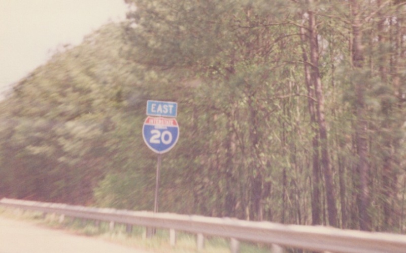
| Eastbound I-20 reassurance shield. This shield both has the state name within the shield and also uses a very thick font for the numerals. Photo taken prior to 2002. |
|
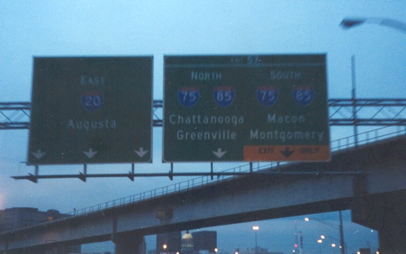
| Early morning view of an overhead guide sign on eastbound I-20, approaching the large interchange at I-75/85 near downtown Atlanta. Photo taken December 28, 2000. |
|
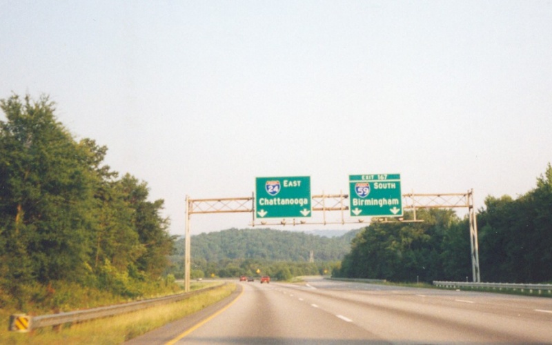
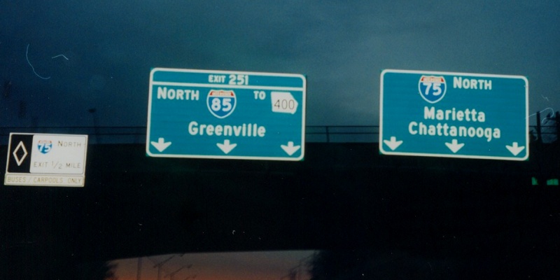
| Overhead guide sign at the ramp to I-59 South from eastbound I-24. I-24 only briefly (about 5 miles) dips into Georgia from Tennessee, so by agreement the exit numbers and mileposts follow I-24's Tennessee mileage. Photo taken July 4, 1999. |
|
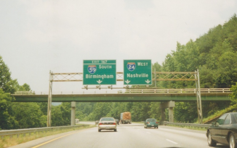
| Westbound guide sign on approach to the same interchange. Photo taken July 5, 1999. |
|
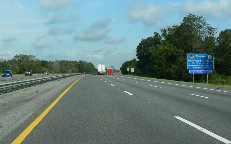
| Georgia welcome sign on northbound I-75. Georgia has had the same (sans Governor on the bottom) welcome sign since at least 1999. Photo taken August 31, 2007. |
|
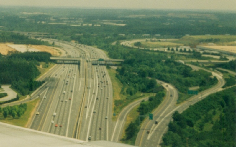
| This photo was taken from an airplane on final approach into Atlanta's Hartsfield Int'l Airport. This is looking to the south on I-75. The bridges for I-285 are in the background to the upper left. This interchange is today's Exit 239 at Aviation Blvd/Charles Grant Pkwy. One notable aspect is that the HOV lanes along I-75 have their own interchange at this point, in the form of a SPUI with all left-hand ramps. Photo taken in May, 2000. |
|
| Overhead guide sign on northbound I-75/85 in Atlanta, approaching the interchange where the two routes split. Photo taken December 28, 2000. |
|
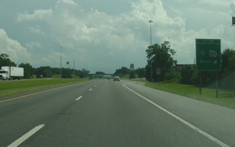
| Southbound I-95 at the GA 251 interchange near Darien. Photo taken August 12, 2003. |
|
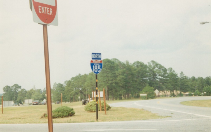
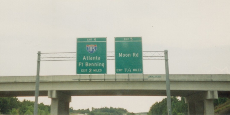
| A rare GA I-185 shield with the state name. Interestingly, I-185 does not begin for another 3 miles north. This is at the beginning of the limited-access freeway within Fort Benning. Photo taken in May, 2000. |
|
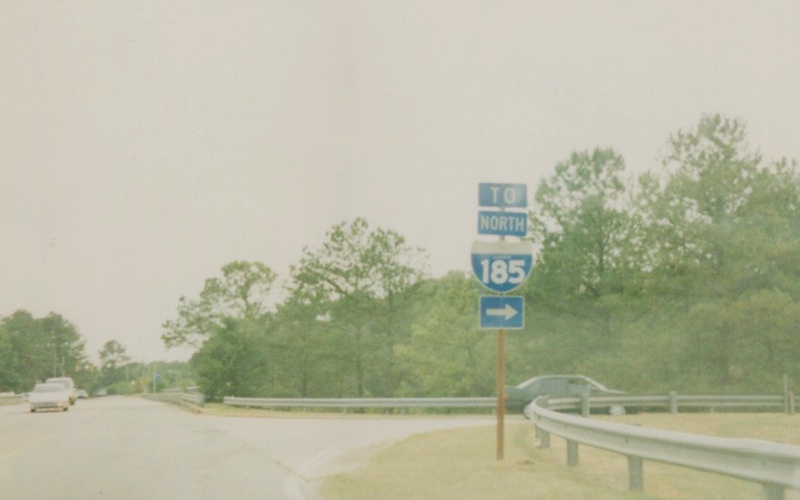
| Another GA I-185 shield within Fort Benning. Notice the difference in styles between the above two shields. Photo taken in May, 2000. |
|
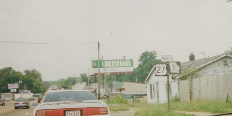
| US 27/GA 1 shields in the Fort Oglethorpe area near Chattanooga, TN. Unlike Alabama and Tennessee, Georgia co-signs the underlying state highway route with its U.S. highways. Photo taken prior to 2002. |
|
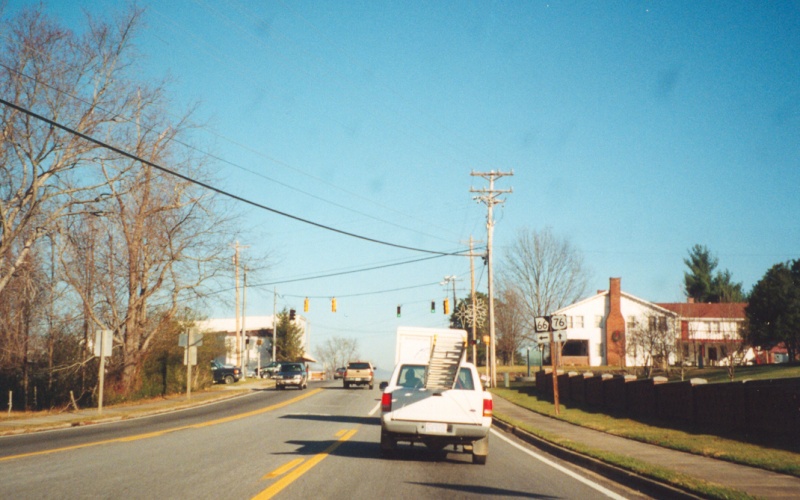
| Eastbound US 76 (with here-unsigned GA 2/GA 515) at GA 66's southern terminus in Young Harris. Photo taken December 1, 2001. |
|
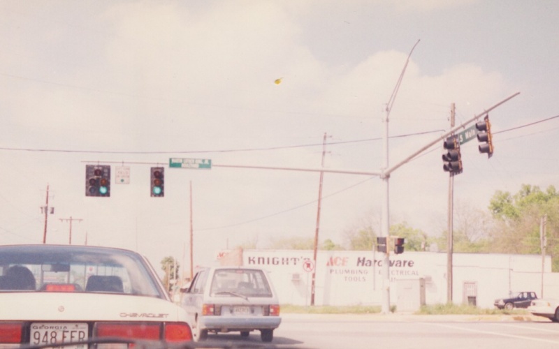
| Overhead signage on westbound US 80 in Columbus. The Georgia side of the US 80 freeway has exit numbers. Photo taken in May, 2000. |
|
| Northbound BUSINESS US 27 at US 278 in Cedartown. Photo taken prior to 2002. |
|
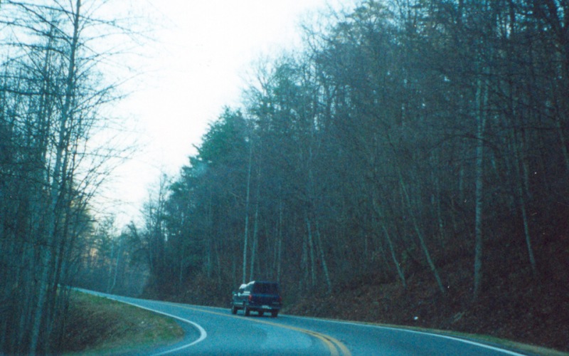
| A curvy segment of GA 52 in southeastern Gilmer County. Photo taken December 1, 2001. |
|
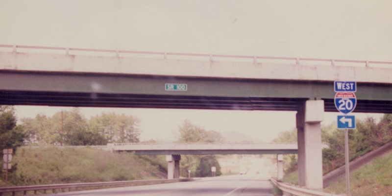
| Northbound GA 100 at the I-20 interchange near Tallapoosa. Note both the state name on the I-20 trailblazer and also the "GA 100" sign on the eastbound I-20 overpass, even though the bridge carries I-20 and not GA 100. Photo taken prior to 2001. |
![]()
Page last modified 16 February, 2008
(C) 2008-2003 Adam Froehlig