Guam Highway Scenes

These photos are from a Navy-related trip I made to Guam in February, 2007, and show various photos and roads on the island.  All photographs were taken by the webmaster in mid-February, 2007.


These 5 photos are of Guam Route 11 (GU 11) or Cabras Hwy, a relatively short route in the northwestern corner of the island.  GU 11 connects GU 1/Marine Corps Drive to the island's power plant, an oil tank farm, and the northern breakwater which in part forms Apra Harbor (the main harbor for ocean-going ships).

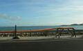
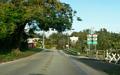
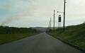
The fourth photo is looking east-northeastward along the northern coastline of Guam.

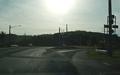
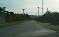
The last photo was unfortunately directly into the sun, and not easy to view, but shows the eastern end of GU 11 at GU 1.


These 4 photos are along northbound GU 14B, locally known as Ypao Rd.  This route, located in Tamuning, is one of three connectors between GU 1/Marine Corps Drive and the hotels located along Tumon Bay.  As noted in the last photo, GU 14B/Ypao Rd ties directly into the Hilton Guam Resort.


These six photos show GU 18, which is mostly a port access road, connecting GU 1/Marine Corps Drive to a dry dock and the Guam Port Authority.

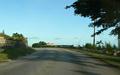
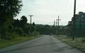
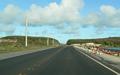
This is also one of the few roads I saw on the island that painted the centerline instead of using bots dots.

Back to Guam Photography
Back to Highway Photography

Page last modified 18 February, 2008

(C) 2008, Adam Froehlig