|
Duplex Location |
Length (mi) |
Signed directions |
| Arden Hills/Mounds View |
1.9 |
I-35W N-S |
|
Duplex Location |
Length (mi) |
Signed directions |
| Arden Hills/Mounds View |
1.9 |
I-35W N-S |
Photographs
|
|
Northbound at the exit to County Road I. In the early road days, Ramsey County decided to assign letters to its road names north of the St. Paul city limits, with the east-west road 1 mile north of the city limits being County Road B, the road 2 miles north being County Road C, and so on. Photo by Adam Froehlig, taken June 26, 2004. |
|
|
Northbound at the I-35W/US 10 split. When the new US 10 freeway alignment was completed in 1999, US 10 was rerouted to duplex with I-35W for about 2 miles. Photo by Adam Froehlig, taken June 26, 2004. |
|
|
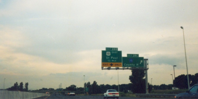
Southbound at the County Rd H interchange, which is a partial interchange allowing access to/from CSAH 10, as the main 35W/US 10/CSAH 10 interchange itself is only a partial interchange. Photo by Adam Froehlig, taken in 1999. |
Back to Minnesota Multiplexes
Back to Highway Photography
Last Updated: September 30, 2006
(C) 2005, Adam Froehlig