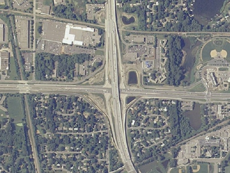
MN 100/MN 55 Golden Valley Aerial Image
These images are courtesy of the National Agriculture Imagery Program, a program of the U.S. Department of Agriculture, and were taken in 2005.
This view, at 5.5-feet-per-pixel resolution, shows the newly reconstructed MN 100/MN 55 interchange in Golden Valley. MN 100 runs north-south, while MN 55 runs east-west.
The original interchange was a cloverleaf interchange dating from the late 1930s that had tight narrow ramps and curves and minimal acceleration/deceleration lanes. Evidence of the original configuration remains in the placement of the frontage roads in 3 of the 4 interchange quadrants, especially the two western quadrants. There were also right-in/right-out intersections on MN 100 north of the interchange.
In 2001-2002, the interchange was reconstructed as part of the MN 100 reconstruction project. This represented an upgrade, and in one way a downgrade, of the interchange. The right-in/right-out intersections (and traffic signals further north) along MN 100 as part of its upgrade to full freeway. Full shoulders and a 3rd lane in each direction were added to MN 100. Replacing the antiquated cloverleaf is a modern Single-point Urban Interchange (SPUI for short). The "downgrade" is in the sense that an additional traffic signal was added to MN 55, which already has several traffic signals impacting traffic.
Return to Twin Cites Aerial Images
Return to Twin Cities Highways
![]()
Page last modified 20 May, 2008