

Miscellaneous San Diego Road Photos
This collection of photos shows various locations in and around San Diego.
All photos were taken by the webmaster in October, 2007. Click on a thumbnail for a larger image.
|
|
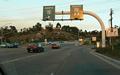
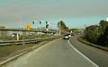
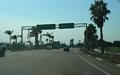
These two photos show the path from eastbound Aero Dr to southbound I-15. Note the two right turn lanes in the first photo, with carpools allowed to use the 2nd lane to turn. The second photo shows what I note was a typical San Diego ramp meter installation where overhead signals were involved. This was mainly where there were three lanes at the ramp meter: two lanes for normal traffic and a third lane (the leftmost in this case) for high occupancy vehicles (HOV-2 here). Most ramp meter installations I saw only had side-mounted meter signals and no HOV lane. |
|
|
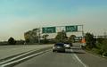
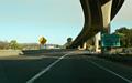
This sequence of four photos shows the somewhat oblong routing one takes going from westbound CA 52 to southbound I-15, a movement that involves two collector-distributor roads, a 25 MPH loop ramp (with a trio of warning signs in the second photo), and avoiding the ramp to Clairemont Mesa Blvd. |
|
|
The ramps from CA 75 to I-5 near Imperial Beach. Note how the adjacent bike path crosses one of the ramps. |
|
|
Two photos along westbound Clairemont Mesa Blvd approaching CA 163. Many maps show the CA 163/Clairemont Mesa interchange as a full cloverleaf, as one can note from the second photo, the interchange has recently been reconfigured. |
|
|
On-ramp from Clairemont Mesa Blvd to northbound CA 163, with a short off-ramp to Kearny Villa Rd (parts of which are old US 395 routing). |
|
|
Ramp from northbound CA 163 to eastbound CA 52. CA 52 only has ramps to/from the south at CA 163, as CA 163 merges with I-15 a short distance to the north. |
|
|
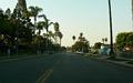
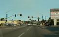
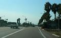
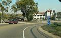
Street scene from along Alameda Blvd in Coronado. Most of Coronado looks like this. |
|
|
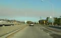
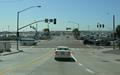
This set of three photos shows the movement from northbound I-5 to eastbound I-8. The ramp meters in the middle photo are from the onramp from Rosecrans St (former CA 209). |
|
|
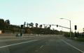
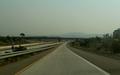
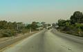
The ramp from eastbound I-8 to northbound I-15 is a tight 20 MPH loop. |
|
|
This ramp split is on the ramp from southbound I-15 to westbound I-8. |
|
|
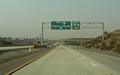
Two photos showing the ramp from northbound I-805 to northbound CA 15. |
|
|
Northbound Midway Dr at Riley St. Note how protected-permitted signals in San Diego use a doghouse-style signal on the mast arm. |
|
|
Two photos showing the split between Nimitz Blvd and Sunset Cliffs Blvd, just southwest of the western terminus of I-8. |
|
|
West/northbound Nimitz Blvd at Rosecrans St. |
|
|
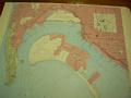
This old topographic map of central San Diego was found on the Navigation Plot table on the Russian Foxtrot-class submarine that is part of a museum in San Diego. Based on the lack of Interstate highways, but the presence of a couple freeways (what is now CA 163 as well as I-5 to the southeast of downtown), my guess is this topo map dates from between the late 1940s and the mid 1950s. Both a larger (250kb) and an extra-large (1.3mb) version of the photo are available. |
|
|
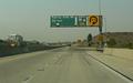
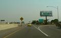
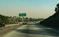
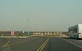
The north end of Santo Rd, at the ramp to westbound CA 52. The empty expanse ahead is part of the Miramar Marine Corps Air Station. |
|
|
Westbound Sassafras St at Pacific Hwy. This area is on the east edge of San Diego International Airport and has several car rental and airport parking lots in the vicinity. |
|
|
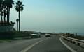
Two photos along Sunset Cliffs Blvd in the Ocean Beach part of San Diego, including where Sunset Cliffs Blvd ends and becomes Ladera St. I also have a webpage with several photos of the Sunset Cliffs themselves. |
|
|
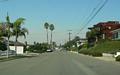
Heading uphill on Ladera St, just past the south end of Sunset Cliffs Blvd. |
|
|
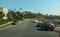
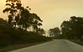
Residential scene along Cornish Dr, a little uphill from Sunset Cliffs Blvd. |
|
|
Eastbound Taylor St, where it becomes Hotel Circle. This is also one of the signed routes from the "Old Town" area of San Diego to I-5 and I-8. |
|
|
"State-name" Interstate shields on Hotel Circle, heading towards westbound I-8. |
|
|
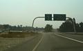
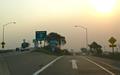
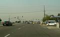
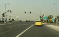
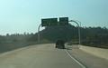
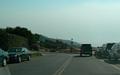
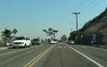
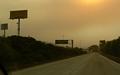
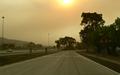
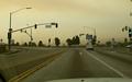
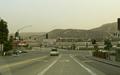
This sequence of four photos shows the last exit on southbound I-5 before the Mexican border: to the Camino de La Plaza in San Ysidro. The hazy sky color is due to smoke from the Harris fire. |
|
|
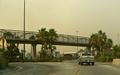
Eastbound on the Camino de La Plaza, in San Ysidro (just north of the border) at San Ysidro Blvd (which might have been US 101 at one point). The southern end of the San Diego Trolley is in the near background, with a BNSF rail line behind that. |
|
|
This is the on-ramp from the San Ysidro area of San Diego (right at/just north of the Mexican border) to northbound I-5 and I-805. The pedestrian crossing connects a large parking area to the border station. |
Back to Froggie's San
Diego area highway photos
See some of Froggie's non-road-related
San Diego photos
Back to Highway
Photography
![]()
Page last modified 17 November, 2007
(C) 2007 Adam Froehlig