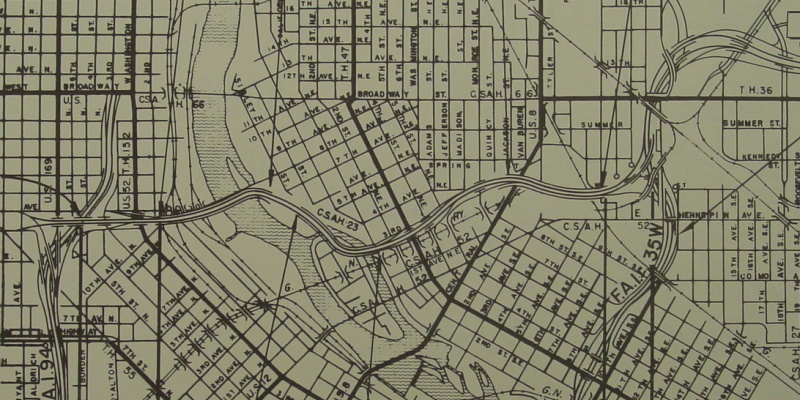
1964 - I-335
This 1964 map shows the first rendition of I-335. Note the almost-fully elevated proposal at the time, and how I-335 dipped onto the northeast corner of Nicollet Island.
Back to I-335 page.
Page last modified 24 February, 2008