Hidden Mississippi Highway 937
|
Western Terminus: |
At US 84/MS 13 in southern Prentiss, Jefferson Davis County |
|
Eastern Terminus: |
Likely at MS 42 in Prentiss, Jefferson Davis County |
|
Distance: |
0.23 miles |
|
Counties Served: |
Jefferson Davis |
|
Cities/Towns Over 5,000 Population: |
none |
Average Annual Daily Traffic Ranges (2004)
|
Jefferson Davis County: |
Not Available |
Froggie's Notes:
- This route follows Columbia Ave (which at one point used to be US 84 and MS 13) from the southern US 84/MS 13 junction northeast into Prentiss. While the original description has it extending to where Columbia Ave crossed a former rail line (which is now part of the Longleaf Trace multipurpose trail), the mileage listed in the 2004 Selected Statistics book suggests it ends at MS 42, barely 1/4 mile northeast of US 84/MS 13.
Froggie Suggests:
- Decommission it, since the city already maintains it according to the Selected Statistics book.
Photographs:
2004 Aerial Photos
All aerial photos are pulled from aerial imagery provided by the National Agriculture Imagery Program, via the Mississippi Automated Resource Information System.
|
|
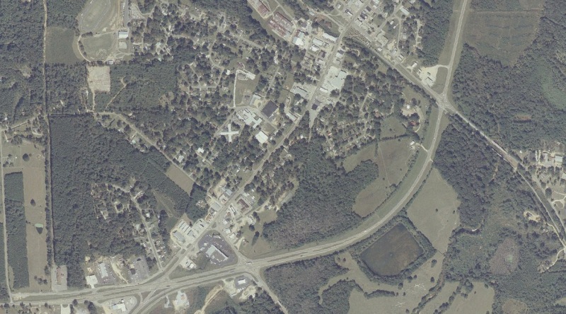
This aerial view shows MS 937's western terminus at US 84/MS 13 (near the lower left), it's "description ending" at the rail-to-trail Longleaf Terrace (upper middle), and it's likely current ending (or the "mileage ending") at MS 42 (near the lower middle). This image also shows most of the present-day US 84/MS 13 bypass of Prentiss. MDOT is building a brand new 4-lane bypass to the north and west for US 84. |
Other Photos
No photographs available.
Back to Mississippi Highways
Back to Highway Pictures
Back to Highways Page
Back to Main Page
Last Updated: February 9, 2006
(C) 2006, Adam Froehlig