
Hidden Mississippi Highway 969
|
Northern Terminus: |
Just north of Barkley Rd along Edwards St, Hattiesburg, Forrest County |
|
Southern Terminus: |
At US 49 and Edwards St, Hattiesburg, Forrest County |
|
Distance: |
0.85 miles |
|
Counties Served: |
Forrest |
|
Cities/Towns Over 5,000 Population: |
Hattiesburg |
Average Annual Daily Traffic Ranges (2004)
|
Forrest County: |
Not Available |
Froggie's Notes:
- Follows Edwards St from
US 49 to just north of Barkley Rd.
- Its orientation suggests that it may have been an old routing of US 49.
It's companion road opposite of US 49, Elks Lake Rd, is also known as Old US 49.
Froggie Suggests:
- Decommission/turn it back to the city.
Photographs:
2004 Aerial Photos
All aerial photos are pulled from aerial imagery provided by the National Agriculture Imagery Program, via the Mississippi Automated Resource Information System.
|
|
The southern terminus, where Edwards St (running to the NNE) meets US 49. |
|
|
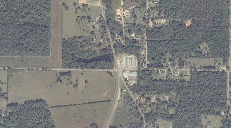
Approximate location of the northern terminus. Edwards St goes from SSW to the NNW. Freeman Rd/Barkley Rd is the east-west road through the middle of the image, and it is just north of this road where MS 969 ends. |
Other Photos
No photographs available.
Back to Mississippi Highways
Back to Highway Pictures
Back to Highways Page
Back to Main Page
Last Updated: 19 January, 2006
(C) 2006, Adam Froehlig